all travel ideas for your Ethiopian journey in Omo Valley and Rift Valley
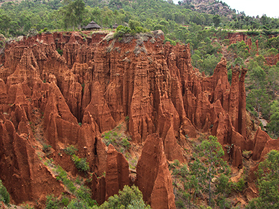
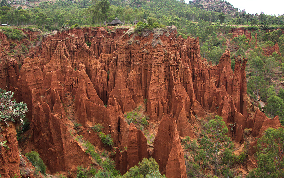
The Great Rift Valley cuts across Ethiopia; a long fault extending from the south of the Red Sea to Mozambique. This fault is the only geological feature of the Earth that can be seen from the moon. It was the moving of tectonic plates which started twenty million years ago that produced this deep pit where regular volcanic activity is felt to this day, as shown by numerous hot springs and craters of dead volcanoes.
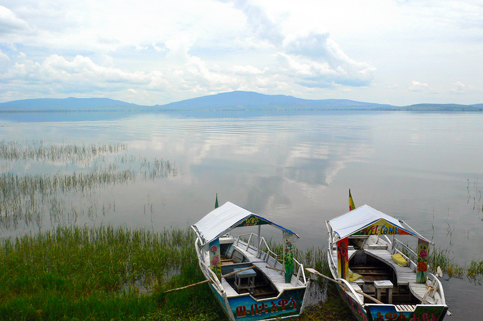
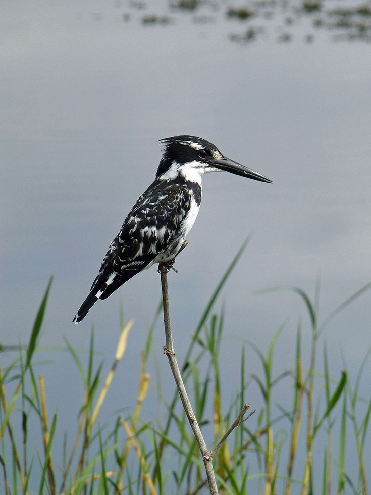
South of Addis-Abeba the Rift Valley is graced by a smattering of seven big lakes, five of which are situated between the capital and Awasa. They are supplied by numerous rivers flowing from the high plateaus. Lake Ziway, 160 km south of the capital, boasts five islands - the biggest of them Tullu Guddu means a big mountain in Oromian, the language spoken in Rift valley. According to a legend, an old stone church on the lakeside of which only ruins remain used to be a home for the Ark of the Covenant after the fall of the Axum reign. Quite shallow, not exceeding 4 metres in depth, the lake covers a surface of 432 square metres, almost identical to that of the Geneva Lake in Switzerland. The lakeside is rich in exceptional fauna and it is easy to spot numerous bird species in the shadow of sycamore fig trees: cormorants, herons, marabouts, pelicans, ibises…
Langano lake is to be found 225 km from the capital. The capital-dwellers appreciate its sweet copper-colored waters, its sand beaches and its small isolated bays. As crocodiles do not approach its west banks, swimming there is safe. Covering the surface of 230 square kilometres, the Langano lake reaches 46 metres in depth; relaxing, walking and restful breaks in the shade of acacias as well as tilapia fishing are to be enjoyed there.
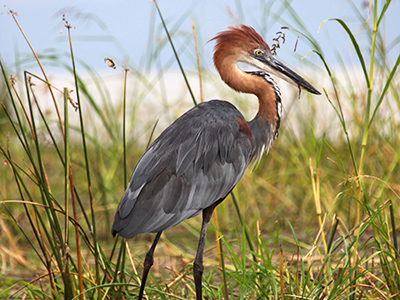
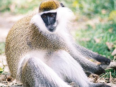
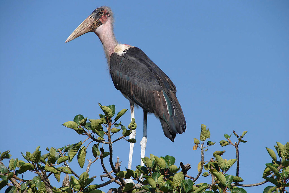
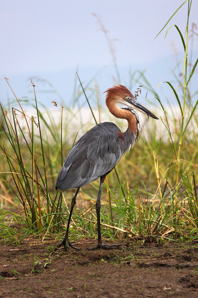
Finally, the national park of the Abijatta and Shalla lakes offers panoramas of great beauty and, with its over 300 kinds of birds, is an ideal place for birdwatching. Abijatta Lake's fish population, the biggest one in the bassin Ziway-Shalla is a paradise for birds of that region. Quite shallow, never going deeper than 14 metres, Abijatta lake is encircled by green hills with river Hora Kelo finding its way to the lake by winding among acacia forests. Weaverbirds’ nests hang on the trees similar to Christmas ornaments while guinea fowls, geese and spur-winged plover are preening in the forest. You can also spot, in the air or on the banks, some grey pelicans, bald eagles, African marabouts and many kinds of herons. This lake is a also home for the biggest colony of white pelicans in Africa. As the lakes of the Rift valley are spot on on the itinerary of migratory birds, the local pelicans receive in winter their cousins from the north seeking milder climates, such as northern pintails and garganeys. Separated from Abijatta lake by a rocky barrier, Shalla Lake is, in turn, fed at south-east by Debaba River and, at north-west by Dijo River. It is the deepest lake in the Rift region. This crater lake is set in the middle of an enormous forest of acacias and spurges. A cliff rises 400 m above its waters and the rivers fall abruptly into their 250 metres of depth. Many a thermal source eject boiling water and columns of hot steam rising above the lake's waters are well known in the vicinity of the lake for their healing characteristics. Four out of eight islands dotting the two hundred square kilometres of its surface are home for many birds species living here safe from any natural predators. As the chemical composition of the lake's waters does not allow the lake's dwellers to find any food, at every dawn they fly towards the neighbouring lake. Lazier birds and white pelicans take advantage of currents of ascending air to pass over the rocky barrier between the lakes. Some mammals also live in the park, such as spotted hyenas, golden jackals and black-backed jackals, normally difficult to approach. However, on the plain on the lake banks such animals as Olive baboons, warthogs, porcupine quills and Grant’s gazelles are less skittish and can be seen more often.
The last one, Awasa lake, bears the name of a town situated on its lakeside. Its surface is 129 square kilometres and it offers a very relaxing spot and also beautiful walks on its banks or on the slopes of mount Tabor wherefrom a splendid panorama of the city and its neighbourhoods can be viewed. A boat trip on the lake allows you to enjoy a moment of calm, birdwatching and observing hippopotamuses grouped farther afar in a marshy cove. It is a well known spot for birdwatching where various kinds of kingfishers live side by side with other lake-dwelling birds.
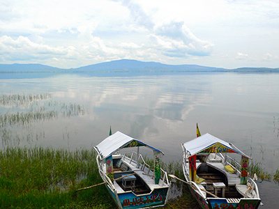
The capital of Gamo Gofa province (forty sources in amharic) overlooks one of the most impressive panoramas of the country, towards the Nechisar plains and lakes Abaya and Chamo. Arba Minch is often regarded as gate to the south, a frontier between two worlds, the last town-stop before the secret and fascinating world begins.
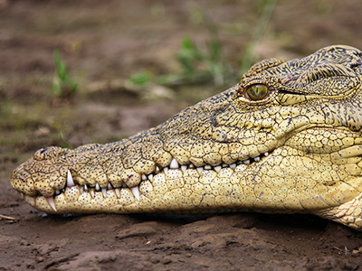
Three major points of interest are to be found in the vicinity of the town: Abaya Lake, the second biggest lake of Ethiopia; Chamo Lake which is home for an impressive population of crocodiles and the Nechisar National Park where more than 300 kinds of birds, including 3 endemic ones, live along with 88 kinds of mammals, reflecting a great biodiversity within a small area. A walk in those natural areas of a great beauty, brimming with animal lives, is always a source of enchantment for visitors.
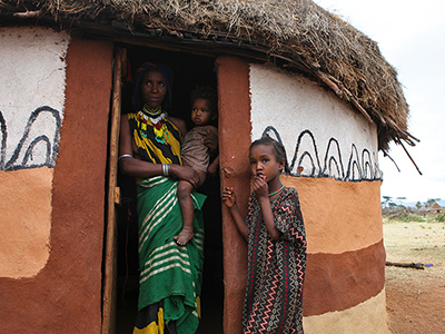
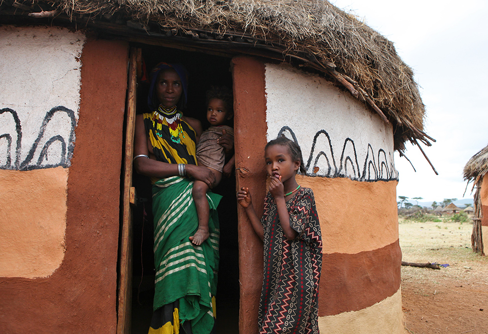
A small village of Chencha, 35 km from Arba Minch, crouched at 2800 metres above sea level is home for Dorze ethnic group. This group belonging to Omotic tribes and isolated in Cushitic Oromo region are reputed to be the best weavers in the world. The Dorze are also smart farmers, but first and foremost, inventive carpenters building majestic homes for themselves. Each and every family in the village is in possession of a plot of land with a characteristic house in the form of a beehive built at its center.
![Mountain Nyalas in the Nechisar National Park - Par Kaffery (Travail personnel) [CC BY 3.0 (http://creativecommons.org/licenses/by/3.0)], via Wikimedia Commons](img/gallery/sud/pic_8.jpg)
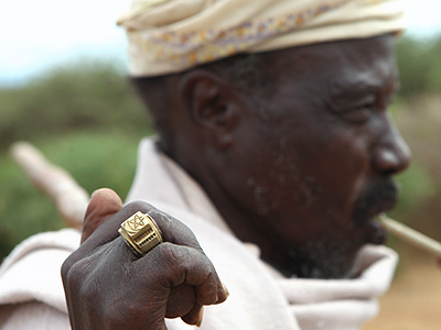
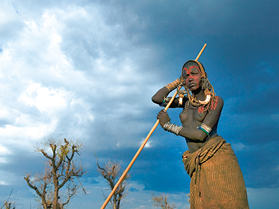
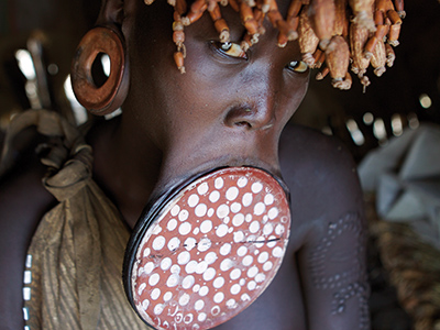
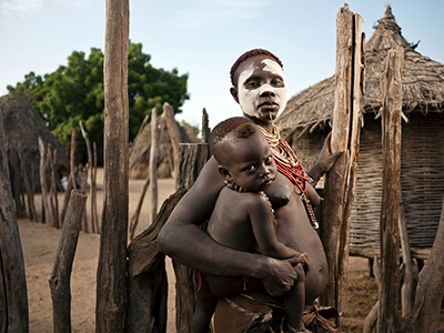
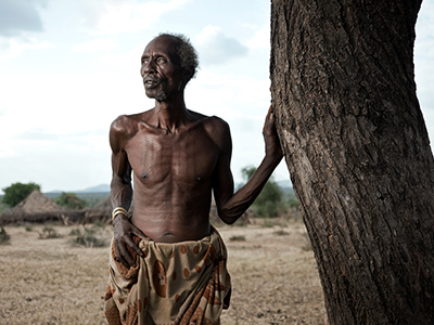
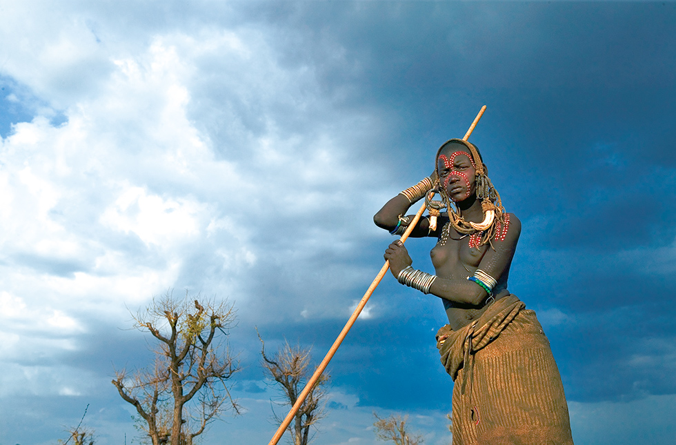
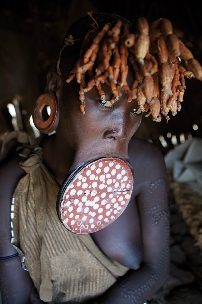
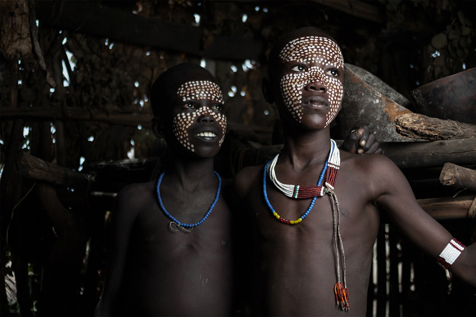
Situated on a rocky slope, the small town of Jinka is the gate to the Mago National Park where one of the most fascinating ethnic groups of Africa live: the Mursi. Traditionally nomadic, the Mursi farm plots of land and complement their food intake by hunting. Women shave their heads and wear big round earrings and still bigger rings in their lower lip. Men sport scars as a proof of their courage as warriors and body paintings for purely aesthetic purposes. Among the last naked warriors left in Africa, the Mursi have the reputation of being, oftentimes, aggressive.
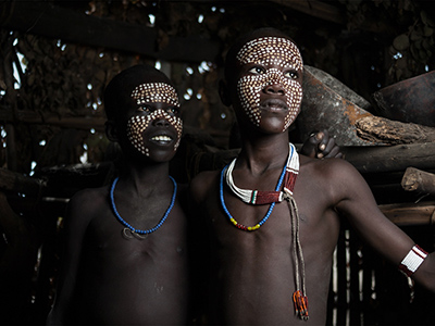
In the same area other ethnic groups, each one still more interesting than the other, can be met. Take the Karos who, living around the Duss village close to the river Omo, sport very sophisticated body paintings in many vivid colours. The Muguji, culturally and linguistically very close to the Karo, are considered by the latter as being inferior to them. Consequently, they live in separate districts. The Daasanach occupy the southernmost part of the Omo delta and are therefore very difficult to reach. Finally, the Bodi living to the north of the Nursi are famous for their decorative paintings and for their scarifications, sported by men and women alike.
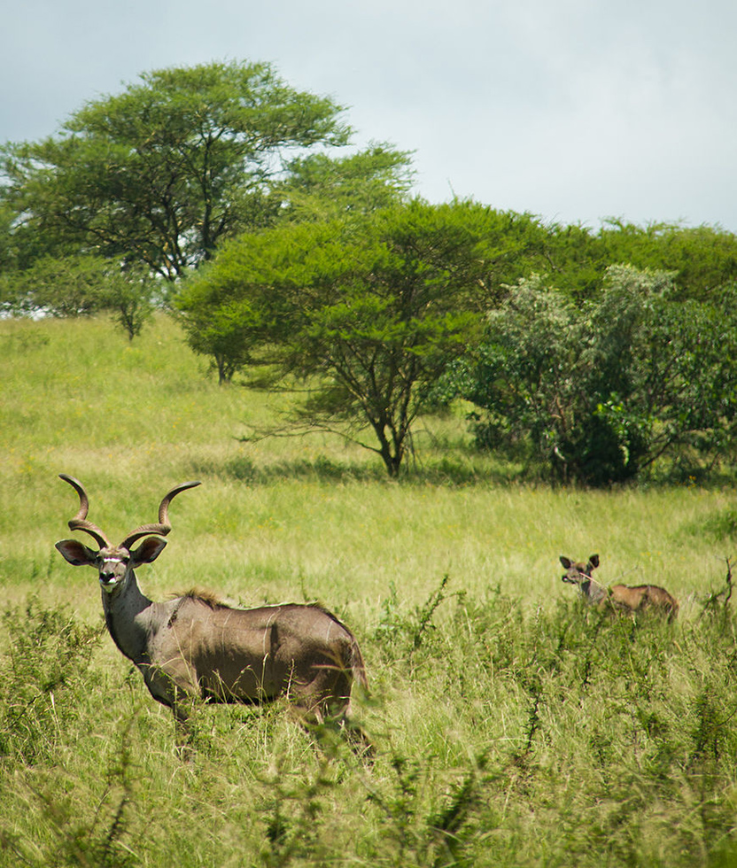
Furthermore, amateurs of wildlife will note that the Mago National Parc is home to over 74 different kinds of mammals and 153 kinds of birds. 315 kilometres of marked roads crisscrossing the park allow to spot many hippopotamuses and crocodiles on riverbanks, a great variety of monkeys, including Colobus monkeys and baboonss and, chance permitting, also buffaloes, giraffes and elephants.
Listed by UNESCO as part of the world heritage, the Konso region is placed in the Rift Valley on a relatively high level of 1,500-2,000m above the sea level. The Konso learnt how to take advantage of this mountainous country by creating on these arid lands an ingenious system of farming on terraces created on the slopes. Despite the fact that their traditional characteristics are close to those of the couchitiques cultures, their cultural, social and economic entity, their aesthetic principles, handicraft, the organisation of their villages and farming methods are different.
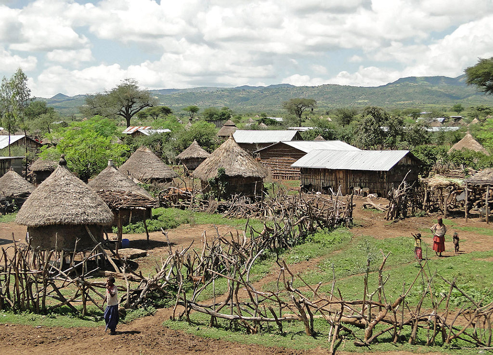
The outlook of Konso villages also differs from that of other ethnicities in the region. To defend themselves against the attacks of wild animals and to protect their villages against mudslides, they build remparts around them, 3 to 4 metres high, using basalt stone and dried mud for building purposes. Inside the remparts the huts of the village stand so close to each other that their roofs overlap. Those densely populated villages count sometimes as many as 2500 inhabitants. The basis of the Konso social relations is determined by a complex system of age categories which also governs their rituals, associated with the cult of old people who hold the essential roles in the community. In the past, the village chiefs known as Poqalla were distinguished by a decoration of a phallic shape worn on their foreheads. Those chiefs are representatives of their clans and, at the same time, spiritual authorities entertaining privileged relationship with their god: Waaq. However, the ritual role of Poqalla tends to disappear. Ritual practices subsist, such as a cult of heroes, of whom Waaq are powerful symbol.
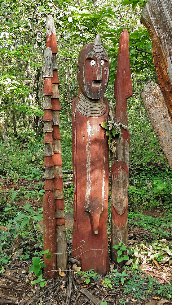
Those Waaq, typical for the Konso culture and who have made the reputation of the tribe, are small totems in sculpted wood, posted in well visible points in memory of brave warriors or hunters. The dead hero is represented decorated with a phallic ornament, in company of his wives and towering over a defeated enemy; the latter easy to be identified as his totem is smaller and he lacks the symbols of virility.
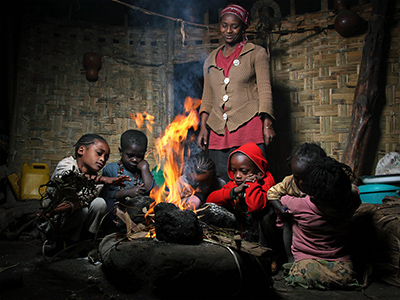
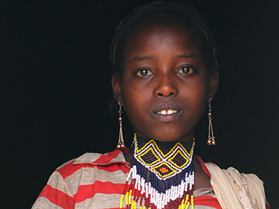
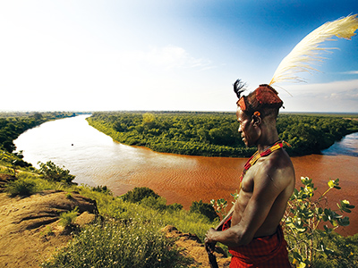
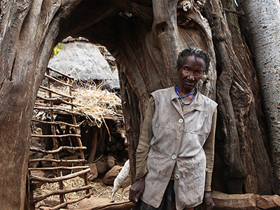
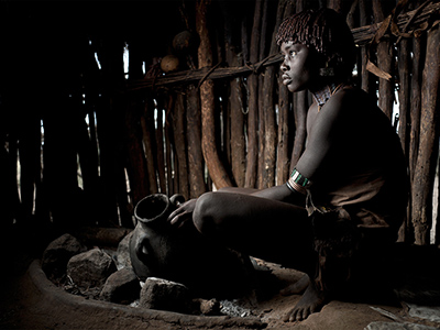
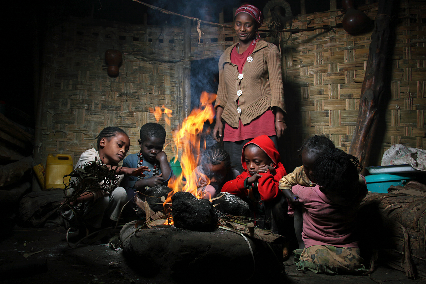
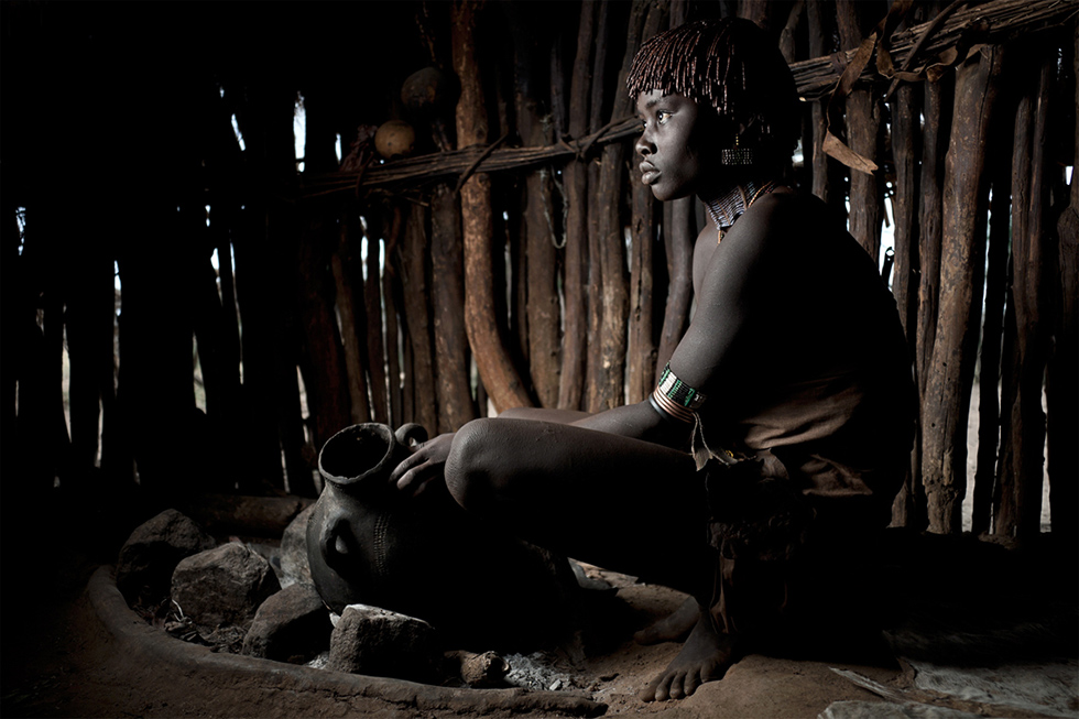
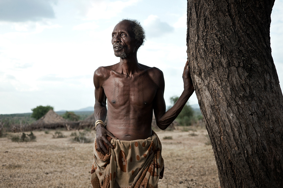
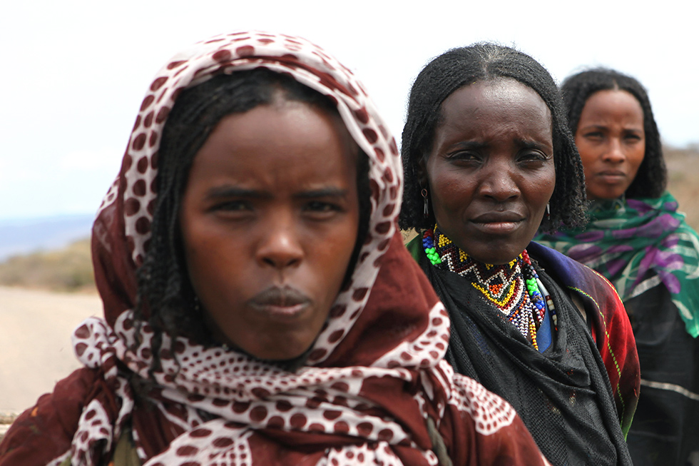
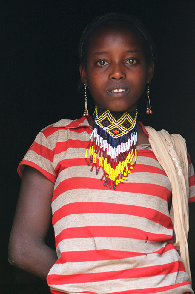
The small town of Turmi does not hold, of itself, much interest for a tourist. However, on market days it draws members of the Hamar community from the surrounding villages. Gathered on a small place, women and children proudly show their accoutrements: short hair adorned with colourful beads, long hair covered in butter and clay, long plaits or hairdos full of feathers... Each detail signals appartenance to a clan, a group, a family. In the surroundings of that little town the Hamar territory extends as far as to the border with Kenya. This pastoral community, estimated at 40,000 persons, attaches only little importance to material goods; they prefer to express their aesthetic tendencies in ornaments and body decoration. The culture of Hamar seems to be impermeable to any and all external influence and makes them one of the most fascinating ethnicities in the region.
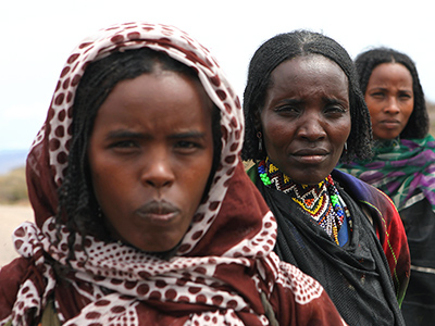
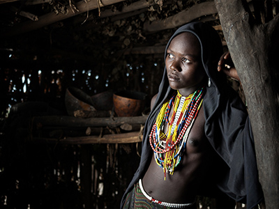
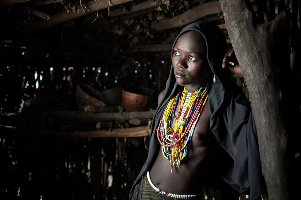
Territories of Tsamai and Arbore extend to the nord of the Turmi lands. Their way of life is essentially pastoral and their languages are both of Cushitic origin. Married women belonging to these tribes are easily recognisable by a stick sewn into their leather skirts, with multiple decorations, tracing a fine track on the ground as the woman walks. The Arbore women can be identified by their numerous bead necklaces and by a black veil they wear on their heads.
Yabelo is a natural starting point for visiting natural sites and attractions of the Borana region. Its main feature is its red and arid earth where rare vegetation is dominated by enormous termite mounds rising like thin chimneys in the middle of villages. Mostly pastoral, the Borana have as their only riches their troops of zebu and quest for water has always been a condition of survival for this tribe. Unique in Ethiopia, the Borana wells hold particular interest. Indeed, every day the clan members are assigned to collect water in turns. Forming a human chain, they draw enormous quantities of water from wells dug to amazing depths, creating sometimes an impression that they reach the innards of the earth. This exhausting work is carried out in a rhythm created by chants, punctuated by deep voices of men and high-pitched women's cries. The resonance of the songs creates a veritable spectacle in the specific atmosphere emanating from this natural cathedral.
Another traditional occupation of this tribe consists in collecting alkaline deposits in crater lakes, necessary for animals and for humans alike. This extenuating work is reserved for men who dive naked, sometimes for more than 5 metres deep, into the dark waters of a lake saturated with salts in order to cut, using big wooden poles, blocks of black slime and bring them to the surface. Part of the booty is given as it stands to the animals; humans consume it after some processing.
Let us know about your wishes and receive a tailor-made travel recommendation designed accordingly.
![Pied Kingfisgher - By Ji-Elle (Own work) [CC BY-SA 3.0 (http://creativecommons.org/licenses/by-sa/3.0)], via Wikimedia Commons](img/gallery/sud/pic_2.jpg)
![Marabout - Par MauritsV (Flickr [1]) [CC BY-SA 2.0 (http://creativecommons.org/licenses/by-sa/2.0)], via Wikimedia Commons](img/gallery/sud/pic_3.jpg)
![A Konso village - By Bernard Gagnon (Own work) [GFDL (http://www.gnu.org/copyleft/fdl.html) or CC BY-SA 3.0 (http://creativecommons.org/licenses/by-sa/3.0)], via Wikimedia Commons](img/gallery/sud/pic_14.jpg)
![A Konso Waaq sculpture - Par Bernard Gagnon (Travail personnel) [GFDL (http://www.gnu.org/copyleft/fdl.html) ou CC BY-SA 3.0 (http://creativecommons.org/licenses/by-sa/3.0)], via Wikimedia Commons](img/gallery/sud/pic_16.jpg)